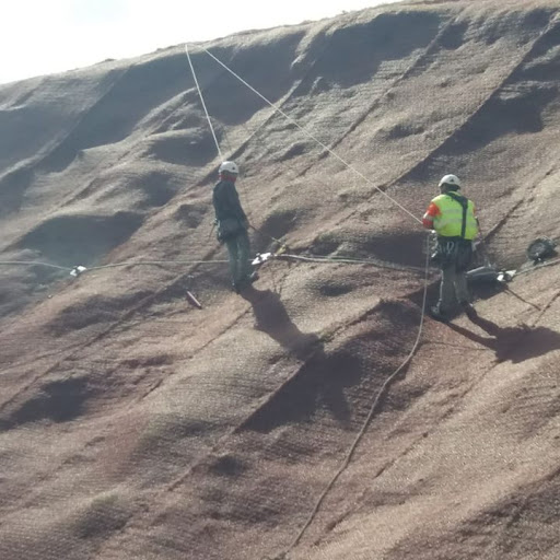
The topographic and geotechnical survey, Pigra Engineering S. L., is a detailed analysis of the land on which a building or structure is to be constructed. The topographic study focuses on the topography of the terrain and its elevation, while the geotechnical study focuses on the geotechnics of the terrain, the characteristics of the soil and the underlying rock.
The price of a topographic and geotechnical study at Pigra Engineering S. L.at Pigra Engineering S. L., varies depending on the size and complexity of the terrain, as well as the geographic location.
In the field of construction and engineering, especially before undertaking any project, Pigra Engineering S.L. usually starts by carrying out a geotechnical and topographical study. These studies provide essential information to assess the feasibility, safety and efficiency of construction on a specific site. Although they are two distinct disciplines, their combination provides an overview that facilitates informed decision-making and reduces the risks associated with construction.
The topographic study focuses on mapping the land surface, identifying key features such as elevations, slopes, water bodies and other geographic features. This information is important in determining the overall layout and design of a structure or project. By knowing the topography of the land, specialist geotechnical consultants such as Pigra Engineering S.L. can design and calculate the appropriate foundations, efficient drainage routes and establish the optimum location for installations. The topographic study also allows for effective planning of the distribution of resources and materials, thus optimising costs and logistics.
The geotechnical study on the other hand focuses on the mechanical and physical properties of the underlying soil and rocks of a construction site. This study analyses the bearing capacity of the soil, its compaction, the presence of groundwater and other factors that may influence the stability of the structure. By determining these characteristics, professionals can select the most appropriate foundation methods and design structures that are safe and durable over time.
The combination of topographic and geotechnical studies provides a complete understanding of the terrain. For example, a topographical study might reveal a steep slope in the ground that could affect the load distribution of a structure. Yet, the geotechnical study may find that the soil has a low bearing capacity, indicating the need to design special foundations or implement specific mitigation measures. This cross-referenced information helps the consulting professionals to make informed decisions and to adapt the design according to the joint field conditions.
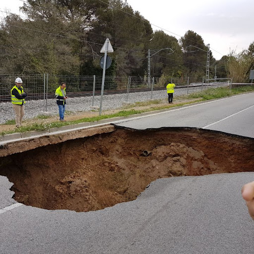
The combination of geotechnical and topographical studies increases the safety of workers and the protection of the environment. Topographical analysis can identify areas prone to flooding or landslides, while the geotechnical survey can warn of unstable ground or the likelihood of subsidence. Combined surveying and geotechnical studies therefore allow safety measures to be implemented and the design to be adapted to mitigate potential risks.
In summary, the joint execution of the geotechnical and topographical studies, as carried out by Pigra Engineering S.L., is a good practice for the success of any construction and engineering project. The information provided by these studies enables professionals to understand the topography of the terrain and the properties of the soil, which in turn influences the design, planning and safety of the project. This combination ensures that the structures are robust, safe and adaptable to the real conditions of the environment, reducing risks and optimising the final results.