


Topographic Survey With Total Station
Total station surveying is a technique, supervised by Pigra Engineering S. L., used to measure and obtain precise data of a terrain or surface. This method combines the technology of a total station with the skills and knowledge of a surveyor to generate detailed terrain maps and plans.
The total station is an electronic instrument that measures horizontal and vertical angles and distances by means of a laser or microwave signal. It also has a screen that displays data in real time and allows the surveyor to make calculations and adjustments in the field.
To carry out a total station survey, the surveyor establishes control points on the ground, which are fixed and known reference points. The total station is then positioned at a starting point and the distance and angle to each control point is measured.

Once all control points have been measured, the surveyor uses the collected data to create a map or ground plan. This plan may include details such as elevation, surface features and the location of objects such as buildings and trees.
Total station surveying is used in a variety of applications, from building construction to road planning and natural resource management. It is particularly useful in projects that require precision and fine detail, such as bridge and dam construction.
However, this method also has some limitations. The total station requires a direct line of sight to the control points, so it can be difficult to use in uneven or hilly terrain. In addition, the data collection process can be time-consuming and requires a high level of skill and knowledge on the part of the surveyor.
In summary, total station surveying is a valuable technique for obtaining accurate and detailed data of a terrain or surface. It is especially useful in projects that require high precision and detail, but it also has some limitations that must be taken into account when using this technique.


The cadastral survey supervised by Pigra Engineering S.L. is an essential process in the territorial planning and management of any country. This consists of the preparation of a detailed plan of a plot of land or property, including information on its location, dimensions and characteristics, as well as the identification of existing structures and elements in the area.
The main objective of cadastral surveying is to establish the ownership and limitations of a piece of land, which is essential for land management decisions. This includes urban planning, real estate regulation and the management of natural resources such as water and land.
In order to carry out a cadastral survey, highly accurate measurement and data recording techniques are used, such as GPS (Global Positioning System) technology, photogrammetry and remote sensing. These techniques allow detailed and accurate information to be obtained about the terrain and its features, which is essential for the production of plans and maps.
Once the information has been obtained, plans and maps are drawn up, including information on property boundaries, location of structures and features, slopes, water bodies and any other relevant features of the area.
Cadastral surveying is a complex task and requires specialised personnel and high quality technical equipment. In addition, it is important to note that the information collected is confidential and must be handled with care and protected appropriately.
In short, cadastral surveying is essential for land management and urban planning. It provides valuable information on the ownership, constraints and characteristics of a piece of land, which is essential for making informed decisions regarding land management as well as real estate regulation.
A total station is a surveying instrument used to measure distance, elevation and direction in a given terrain. These tools are indispensable for accurate and detailed surveying and are widely used in the construction, mining and engineering industries.


The price of a total station can vary significantly depending on the make, model, features and technical specifications. Some of the most popular brands of total stations include Leica, Sokkia, Topcon, Trimble and Nikon.
The cheaper models are usually used for simple work and do not require high accuracy, while the more expensive models are needed for highly accurate and complex work, such as large-scale topographic surveys or large-scale civil works. However, it is important to bear in mind that the price of a total station is not the only factor to consider when choosing one, as the features and technical specifications of each model, as well as the reputation and quality of the manufacturer, must also be taken into account. Ultimately, the choice of a total station will depend on the specific needs of each project and the available budget.

The total station is an indispensable instrument in the field of surveying and civil engineering. This tool is used to measure horizontal and vertical angles, as well as distances and elevations, making it a very useful tool for surveying, road and bridge construction, urban planning and other similar applications.
The total station consists of a theodolite, a distance meter and a data processor integrated into a single device. The theodolite measures horizontal and vertical angles, while the distance meter uses laser or electromagnetic wave technology to measure distances. The data processor stores and processes the information measured by the theodolite and the distance meter and displays it on an integrated display.
Modern total stations are extremely accurate, with a typical accuracy of 1 to 5 arc seconds for angle measurements and 2 to 5 mm for distance measurements. In addition, many total stations are equipped with advanced features, such as the ability to make measurements without the need for a reflector prism, wireless connection to other devices, and the ability to record and process large amounts of field data.
Total stations are used in a wide variety of applications, including road and bridge surveying, urban planning, building construction, mining, agriculture and mapping. In surveying, total stations are used to make accurate measurements of the angles and distances between points of interest in a terrain, allowing the creation of detailed maps and three-dimensional terrain models.
In road and bridge construction, total stations are used to measure angles and distances between points of interest on the ground, allowing engineers to design the curves and slopes of roads and bridges with millimetre accuracy. In urban planning, total stations are used for surveying and determining the precise heights and locations of buildings and other urban structures. They are also used to establish property boundaries and lot lines, which is essential for land use management and sustainable urban development. In addition, total stations are an important tool for geotechnical surveys, which are used to assess soil quality and geological ground conditions, helping engineers and architects to design safe and resistant structures. In summary, total stations are a fundamental tool for infrastructure planning, construction and urban development.
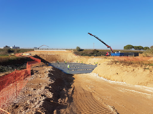

The topographic survey is a supervised surveying technique at Pigra Engineering S. L. used to determine the shape, size and position of objects and features of the earth’s surface. This technique is used in a wide variety of fields, including architecture, civil engineering, construction, mapping, urban planning and environmental management.
Surveys are carried out using a variety of surveying instruments, including total stations, GPS (Global Positioning System), LIDAR (Light Detection and Ranging) and drones. Each of these instruments has its own advantages and disadvantages and is selected according to the specific needs of the measurement task.
The surveying process begins with the establishment of a network of control points on the earth’s surface. These points are precisely marked using stakes, and their coordinates are measured using precise measurement techniques. These control points are used as a reference for the rest of the measurement, and are used to correct any measurement errors in the process.
Once the network of control points has been established, the measurement of the points of interest on the land surface is carried out. This is done by using precise measuring instruments, such as total stations or GPS. The points of interest are measured in three dimensions, allowing the creation of a three-dimensional model of the earth’s surface.
Once all points of interest have been measured, specialised software is used to create a three-dimensional model of the surface or object that has been scanned. This model can be used for a wide variety of applications, from manufacturing precision parts to creating 3D animations for the entertainment industry.
The process of creating a three-dimensional model from scanned data is known as “3D reconstruction”. Depending on the accuracy required and the input data available, 3D reconstruction can be a complex process requiring a large amount of time and computational resources.
However, once the three-dimensional model has been created, a variety of tasks can be performed, such as precise measurements, simulations of physical behaviour and deformation analysis. 3D reconstruction has also been used in a wide range of applications, such as engineering, medicine and archaeology, to aid research and decision-making.
A total station is a surveying instrument used to measure angles and distances on the ground. It consists of a theodolite, which measures horizontal and vertical angles, and a distance meter, which measures the distance from the total station to the object being measured.
The use of a total station has become an essential tool for surveyors and other professionals in the construction industry to accurately measure the location and elevation of points on the ground. One of the main advantages of a total station is its ability to measure accurately over long distances, allowing professionals to measure large and complex areas.
The use of a total station can be manual or automated. In the case of a manual total station, the user must manually point the total station at the object being measured and manually record the angles and distances. Although this may be more laborious than using an automated total station, a manual total station is still very useful in certain situations where automation is not possible or not necessary. For example, in very rugged terrain or in projects where high accuracy is required, the use of a manual total station may be preferable due to the user’s ability to adjust the position and orientation of the total station more accurately than an automated total station. In addition, a manual total station can be cheaper and easier to transport to remote sites where access to electricity may be limited. In summary, the use of a manual total station remains a viable and useful option for certain surveying applications.